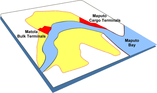
The Port of Maputo contains two main port areas.
There is one access channel from the open sea leading into Maputo Bay, the North Channel with a maximum depth of 14.4m (Canal do Norte). The channel passes to the North of Portuguese Island (Ilha dos Portugueses) and is well marked by light buoys.
The distance from the North Channel entrance at Buoy 1N to the Pilot Station at Buoy 12P is 25 miles. From the Pilot Station at Buoy 12P the Xefina, Polana and Matola Channels lead into the wharves and terminals.
Depths
| Location | Depth limits * |
|---|---|
| North Channel | 14.4m |
| Xefina and Polana Channels | 13.7m |
| Matola Channel | 13.2m |
* All depths are below chart datum and the actual tide is to be added (please consult tide table of the day). The tide table is published by INAHINA (Instituto Nacional de Hidrografia e Navegação). All navigational aids are provided and maintained by INAHINA.
AIR DRAFT
- Air Draft of 62 meters ONLY for vessels crossing under the Katembe Bridge.
- Air Draft alongside berth 5: 61.5 meter.
| Title | |
|---|---|
|
Quays Design Depths – April 2025 1 529 downloads |
Download |
|
Conditions of Entry 1 759 downloads |
Download |
|
Matola Chart – new edition 646 UKHO 1 667 downloads |
Download |
|
Maputo Chart – new edition 644 UKHO 1 867 downloads |
Download |
|
Emergency Contacts 1 292 downloads |
Download |
|
Nova balizagem Maio 2019 1 356 downloads |
Download |
|
Maputo Port Approach Passage Plan 1 693 downloads |
Download |
|
vIRTUAL bUOYS centreline 1 440 downloads |
Download |
